
GROUNDWATER IS NATURE’S HIDDEN TREASURE
Groundwater is water below the surface of the ground and considered to be nature’s hidden treasure. Groundwater supplies rivers, lakes, wetlands and requires protection for it’s importance. Here is a GROUNDWATER DEFINITION
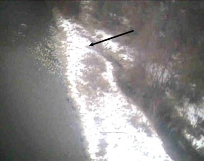
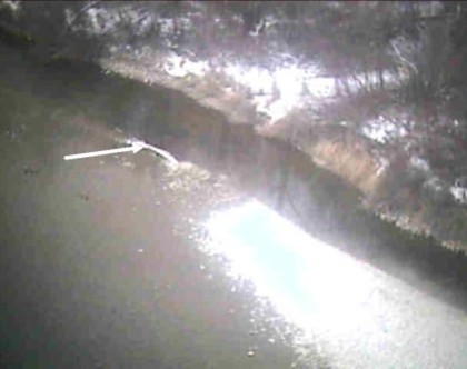
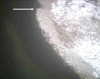
Climate change is one of the biggest threats to the world and is another reason hydrologists, biologists, education, island countries as well as other applicable professionals need to see their groundwater objectives. The next video will show basic aerial imaging of groundwater upwelling within river systems.
The imaging was completed with their biologists, hydrologists and forestry consultants to let them see their objectives. It is very very basic images for the internet and doesn’t include GPS coordinates, temperature scales, etc used in reporting. It is a complicated imaging application because every season has different challenges that can limit or exclude the amount of information available. If you move your mouse over the image, it will freeze, move off the image and other images cycle.
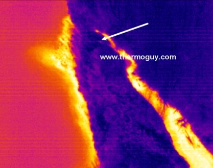
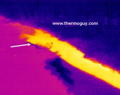
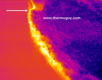
The groundwater application we employed started long before with a pilot study verifying accuracy of water temperature from the air. This application is the result of 1000s of hours of unparalleled Thermal Radiation imaging by professionals consulting on heat transfer at molecular levels.
This is a very basic look at groundwater imaging, there is much more to see in unlocking the secrets of the universe. We lead in taking education outside the calculator, thermostat or thermometer and let them show temperature, not just refer to it.